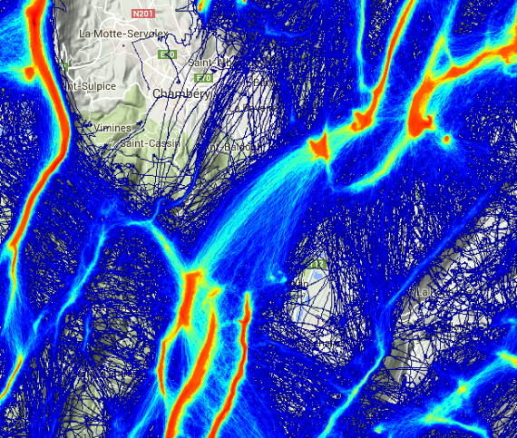
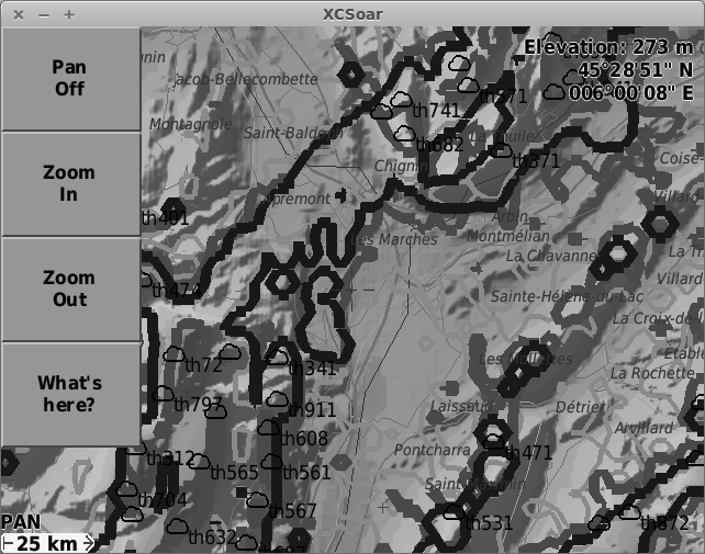
XCSoar map, generated with skyways and SRTM dem 1
Why skyways on XCSoar?
Skyways are the most used route for cross country flight.
XCSoar is a tactical flight computer.
So having the most used routes on my flight computer makes sense when you need to know where to hop from a mountain to another.
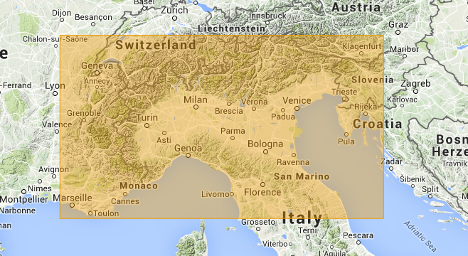
Covered area
The current coverage is 5 15 47 43
Black and white optimised
Skyways are represented in gray level, only with contour (not filled) for eReader/eInk devices
Download map
Have fun!
Sources
SRTM dem1 from viewfinderpanoramas
Skyways from thermal.kk7.ch
References
Custom map generation for XCSoar


Hello,
I found on your website very usefull info. I’ve also use a kobo and I think the skyways will improve my flying. Can you sent me the map for portugal and spain or is a area to big? My atual map is a map that I download from xcsoar and is POR_HighRes.xcm.
Regards
Pedro Reis
thanks for map pyrennees/france
Pretty! This was an extremely wonderful article.
Thank you for providing these details.
Is it possible to make 1 big map set-up with skyways for belgium, france, west germany and the alps. Cause I have already tried to make one of my own and it woun’t work.
thx
great site! thanks.
I am going to fly on Canarian Islands and was wondering if you could provide a map for XCSoar on KOBO?
Unfortunately, I dont have time, but you can follow the tutorial to make your own.
can you please provide the map of Albania?
Again, unfortunately, I dont have time, but you can follow the tutorial to make your own.
help plz
can you be more specific on the tutorial because i am not able to understand it.
plz email me: (edit)@telekom.com.al